


Larimer 433, Larimer County, Colorado
About
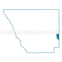
Outline

Summary
| Unique Area Identifier | 548683 |
| Name | Larimer 433 |
| County | Larimer County |
| State | Colorado |
| Area (square miles) | 16.02 |
| Land Area (square miles) | 14.82 |
| Water Area (square miles) | 1.21 |
| % of Land Area | 92.48 |
| % of Water Area | 7.52 |
| Latitude of the Internal Point | 40.54262760 |
| Longtitude of the Internal Point | -104.97114470 |
Maps


Graphs
Select a template below for downloading or customizing gragh for Larimer 433, Larimer County, Colorado


Neighbors
Neighoring Voting District (by Name) Neighboring Voting District on the Map
- Larimer 204, Larimer County, CO
- Larimer 214, Larimer County, CO
- Larimer 228, Larimer County, CO
- Larimer 230, Larimer County, CO
- Larimer 432, Larimer County, CO
- Larimer 434, Larimer County, CO
- Larimer 439, Larimer County, CO
- Larimer 603, Larimer County, CO
- Weld 115, Weld County, CO
- Weld 117, Weld County, CO
- Weld 121, Weld County, CO
- Weld 126, Weld County, CO
Top 10 Neighboring County Subdivision (by Population) Neighboring County Subdivision on the Map
- Fort Collins CCD, Larimer County, CO (157,849)
- Loveland CCD, Larimer County, CO (95,583)
- Windsor CCD, Weld County, CO (19,286)
- Timnath-Wellington CCD, Larimer County, CO (18,311)
- Ault CCD, Weld County, CO (6,601)
Top 10 Neighboring Place (by Population) Neighboring Place on the Map
Top 10 Neighboring Unified School District (by Population) Neighboring Unified School District on the Map
Top 10 Neighboring State Legislative District Lower Chamber (by Population) Neighboring State Legislative District Lower Chamber on the Map
- State House District 49, CO (83,740)
- State House District 52, CO (80,636)
- State House District 65, CO (77,293)
Top 10 Neighboring State Legislative District Upper Chamber (by Population) Neighboring State Legislative District Upper Chamber on the Map
- State Senate District 13, CO (159,077)
- State Senate District 15, CO (155,929)
- State Senate District 14, CO (143,701)
Top 10 Neighboring 111th Congressional District (by Population) Neighboring 111th Congressional District on the Map
Top 10 Neighboring Census Tract (by Population) Neighboring Census Tract on the Map
- Census Tract 17.09, Larimer County, CO (11,580)
- Census Tract 25.01, Larimer County, CO (7,573)
- Census Tract 16.08, Larimer County, CO (5,116)
- Census Tract 23, Weld County, CO (4,619)
- Census Tract 22.08, Weld County, CO (4,588)
- Census Tract 22.06, Weld County, CO (3,582)
- Census Tract 16.05, Larimer County, CO (3,189)
- Census Tract 13.06, Larimer County, CO (2,003)
- Census Tract 22.07, Weld County, CO (1,918)
- Census Tract 16.01, Larimer County, CO (1,681)